At 1,092 metres, Aljibe is the highest peak in the Alcornocales Park and is a fairly serious undertaking
By Nick Nutter | Updated 15 Mar 2022 | Cádiz | Walking |
Login to add to YOUR Favourites ![]() or Read Later
or Read Later

General Description: At 1,092 metres, Aljibe is the highest peak in the Alcornocales Park and is a fairly serious undertaking. However the walk as far as Sauceda, 1.5 kms, is great for a family picnic, there are loads of nice spots next to the river and the walk as far as the forestry road at the head of the valley, about 4kms, can be achieved in trainers. You will see a huge variety of plant and bird life on this walk.
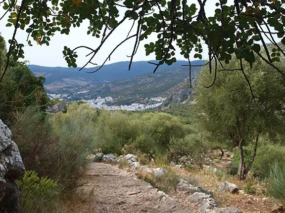
From the road. Go through the green metal gates and follow a path that passes in front of a low building up the hill to the left. This is the reception hut for the cabanas that you will come to later. Just past reception there is a metal gate through a wall and a sign saying ‘Cabanas 1200m’. A path, well marked with white paint on stones wends its way to the hamlet of La Sauceda.
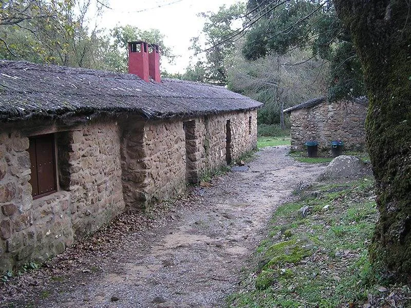
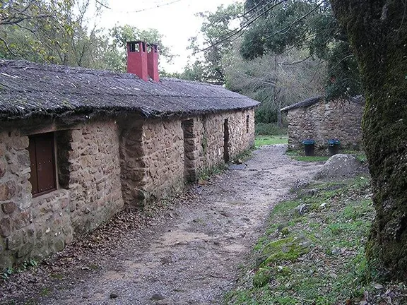
Originally this hamlet survived by milling grain, the ruined mill is hidden away just up the valley, and then when that became unprofitable, it became one of the last hide outs of the smugglers transporting contraband from Gibraltar to the villages of Cadiz and Malaga provinces. Today the cabanas are refurbished and can be hired by the night. Walk through the hamlet to a wooden bridge across the river and a track that takes you up to a small plateau on which there is a ruined church and a refurbished communal bread oven, both dating back many hundreds of years.
Leave the oven to your right and walk up the hill a few metres. You reach a broader track where you turn left. This better track soon degenerates into a rough path as the valley narrows. Keep the river on your left. This valley is one of the canutos for which the Alcornocales is famous. These are narrow sheltered valleys with a high humidity that support a luxurious diversity of plant life. In autumn it is a favourite place for mushroom picking and in mid November we came across a surprising number of types.
Notice, high up in the forks of the cork oaks, ferns growing in the moss. This is evolution in action. Already the fronds are noticeably smaller and more delicate than their ground dwelling relatives and, of course, they are less likely to be eaten by ground dwelling herbivores. They will eventually develop into a separate species. As you walk up the valley the path forks but all lead to the same place, keep the river close to your left. You will eventually see an area on your right that is less
wooded. On one occasion there was a deer in this clearing, you may be lucky.

The path then crosses the same stream twice in quick succession and brings you out on a forestry track next to a concrete water tank where you turn right. After about ½ km you will see on your left signposts for the path to the top of Aljibe. At this point you have less than 2kms to go but you gain about 300 metres in height so it is steep but, with its exuberant vegetation, including a cork oak with a lower trunk so swollen it resembles a baobab tree, interesting enough to take your mind off the gradient.
There are some large swathes of rhododendron on this stretch that were budding in November and should flower spectacularly in February or March. After this short but energetic climb the path emerges on a ridge and continues up to a junction. Your way is signposted to the left. The vegetation quickly becomes smaller
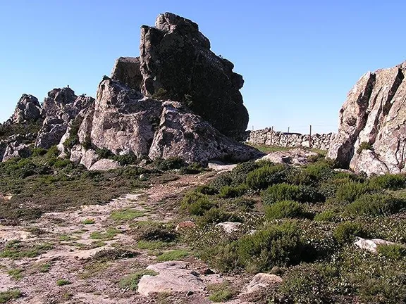
on this last stretch, unable to cope with the wind and exposure out of the valley and you realise you are on a high, rounded ridge with, ahead, exposed buttresses of rock. The first buttress you reach is known as the Queen’s Bath. Legend has it that Queen Isabella visited this spot during the reconquest and partook of a bath.
You will see the trig point marking the summit just ahead on another buttress but the way is barred by a new (November 2006) barbed wire fence on top of an open metal fence. There are no signs to indicate humans are not allowed to easily go between the fence bars to follow the well marked path to the summit. The choice is yours.
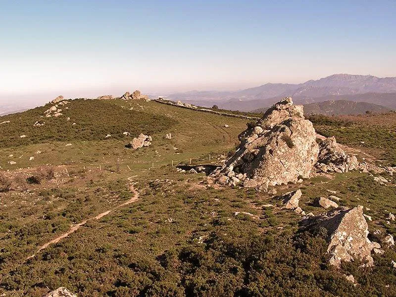
From the summit everything you see is below you and the horizon all around is vast. On a clear day you will see Gibraltar and Morocco, the mountains of Ronda, Grazalema and Gaucin, the town of Jerez and across the plains of the Rio Guadalquivir towards Seville. Eagles sore in the valley below you. It is one of the most breathtaking views you will ever see. If you can take your eyes from the view then look at the vegetation here. There are clumps of oak, complete with oak apples in season, but no higher than a few centimetres, naturally pruned by the almost constant high winds.
The walk returns by the route you followed up. Once you are in the valley below the forestry track you can veer left at an obvious fork to stay on a higher path that brings you down to the top of one of the large slabs of rock you will have seen on your way up the valley. It then takes you between two such slabs and it is here that you will find the very ruined mill tucked away between the rocks and rapidly being reclaimed by nature. This path then rejoins the one you took earlier.
Start and Finish: Sauceda
Distance: 12Km
Time: Allow 5 hours
Essential Equipment: Walking shoes or boots, water or flask. For this walk I would also advise a simple first aid kit, sun block cream, waterproof and windproof jacket.
© Visit-Andalucia 2015 - 2024
 Ubrique to Benaocaz - A Walk up a Roman Road