The Utrera Gorge Walk takes in Manilva village, the Roman Baths, Utrera Gorge and returns through Sabinillas
By Nick Nutter | Updated 29 Aug 2022 | Málaga | Walking |
Login to add to YOUR Favourites ![]() or Read Later
or Read Later

Utrera Gorge
A circular route starting and finishing at Puerto de la Duquesa and taking in Manilva village, the Roman Baths, Utrera Gorge and returning through Sabinillas. There are a number of options to shorten the route that will be obvious in the description. This walk takes us to a feature that is equally as magnificent as Torcal, across countryside as pretty as any you will find and through a well preserved white village. Its features are as historically and geologically important as any in Andalucia and the beauty of it is that it is right on our doorstep. The majority of the walk is on roads and good track.

Utrera Gorge
A convenient place to start this walk is one of the car parks in Puerto de la Duquesa. From there walk under the A7 and follow the road up the hill with Manilva Autos on your left. At the next junction bear left, still uphill, past Monte Duquesa, and through the urbanisations. In just over a kilometre from Monte Duquesa you will come to a roundabout that you go directly over. At the next roundabout, in one hundred metres, turn right. Even though you are on the outskirts of the new buildings you have good views west towards Manilva, the church being its most prominent feature, the Sierra Nieves in the far background and the sea off to your right. Below you is a narrow valley full of grape vines and allotments.
You descend a hill through urbanisations until the new build abruptly stops and you are on a concrete track taking you through allotments and vine groves. Cross a concrete bridge over a stream and the track climbs onto the ridge on which Manilva is situated. Turn left and walk to the roundabout at the west side of Manilva village.
Walk straight through Manilva, staying on Calle del Mar. On the far side of Manilva you rejoin the A377 road.
Utrera Gorge
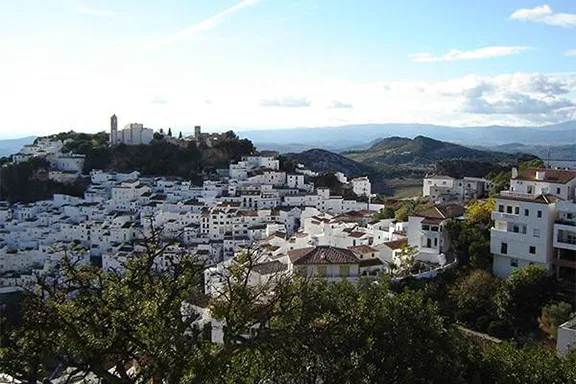
The village of Manilva is comparatively recent having been established in 1530 in an effort to repopulate the coastal area. The original church of Santa Ana was destroyed by an earthquake in 1722 and rebuilt in 1776 to once again stand overlooking the oldest part of this pretty village. Unspoilt by industrialisation Manilva has always made its money from farming, including at one time sugar cane, and grapes. The celebrated grape festival takes place during the first weekend of September each year.
On your right you will see a wooden signpost indicating the walking route to Casares. If you take this track you will descend steeply to the Roman Oasis Road where you can rejoin the route described here to give you a round trip of about 10 kms, all on good road or decent tracks.
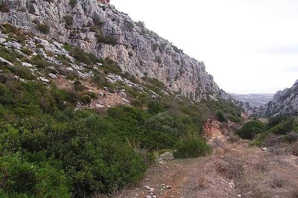
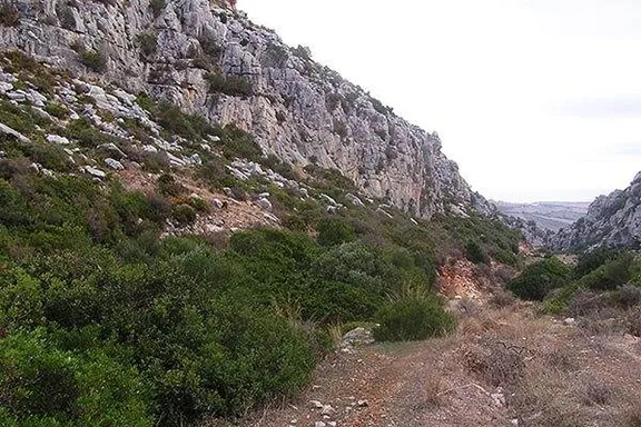
Continue down the main road until you reach the roundabout just before the toll road bridge. Cross the bridge and take the road signposted Casares. The first kilometre or so is spoilt on your right by the disfigurement of the quarries, steadily and rapidly eating away at rock laid down 150 million years ago. As you walk further down this road you will see close by on your left the 21st century windmills sedately revolving to produce electricity with a deep hum whilst on your right you have an increasingly more rugged limestone ridge. You will be on this road for just over 3 kilometres at which point you will see a farm track on your right with a cattle grid and a Junta walking sign.
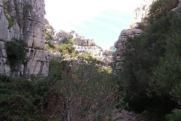
Walk down the farm track. Bear right at the first track junction and left at the second. Through the farm buildings and continue down a rough track. Ahead you will see the limestone ridge of Utrera with the gorge opening up as you approach. You will then arrive at the site of mine workings, the settling pits and building foundations, long abandoned, and the track starts to descend steeply. Parts of the path are washed away so a certain amount of agility is called for but the whole of this section is well marked with white and green painted stripes on rocks so it is difficult to stray far from the path as you descend through the gorge.

Utrera Gorge
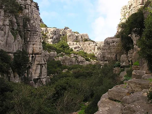
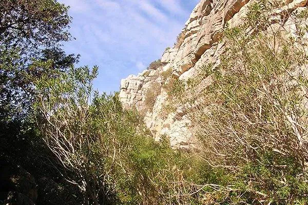
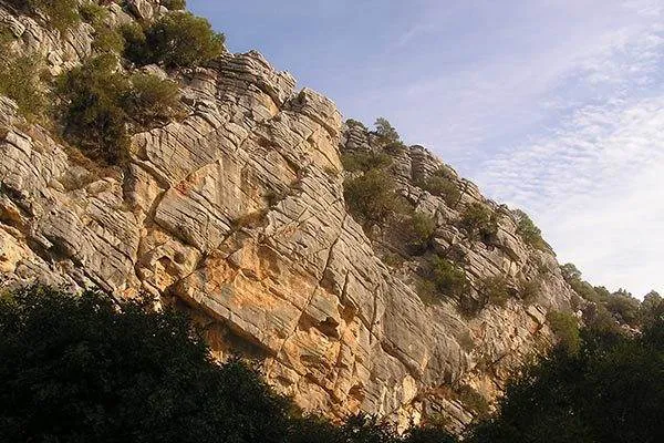
The gorge is a unique feature in Andalucia. The limestone was laid down 150 million years ago when this part of Spain was on the bottom of the shallow Tethys Sea. It is amazing to see the thickness of this rock, all formed from the shells of sea creatures that abounded in the waters at that time. In some of the strata you can still see the fossil remains of these small animals. When the African tectonic plate pushed into the European plate during the Tertiary era it pushed the limestone layers that stretched from Alicante to Cádiz, over 1,300 metres into the air. Millions of years of erosion reduced the limestone leaving behind isolated outcrops of somewhat harder rock. Utrera is one such outcrop and Torcal near Antequera is another. What makes Utrera unique are the canutos, or canyons, that bite into the ridge allowing us to see the strata. You will clearly see that it is folded and the once horizontal beds are in places now at an angle of about 30 degrees. Continuing wind, rain and frost erosion produce the karstic features you see, towering buttresses and layered overhangs in fantastic sculptured shapes.
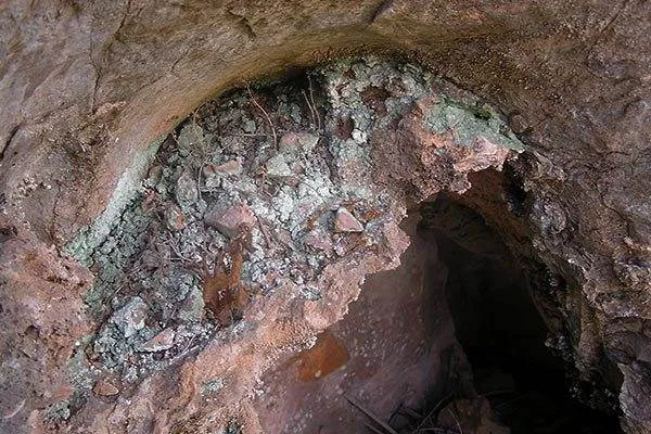
About half way down the gorge on your right is the site of old workings. Cavities in the rocks have green deposits on their surface, a sign of copper, and blocks of rock nearby have the unmistakeable circular holes left by the drills used to make the blasting holes. On the under surface of the strata you will see small fossils, Jurassic shellfish and molluscs. You will notice that some of the wider cracks are filled with a crystalline substance.

Utrera Gorge
The minerals that are found here are all the result of hydrothermal vents. Deep within the Earth’s crust molten magma rises towards the surface. Water in the magma, superheated and at great pressure, dissolves metallic and mineral elements from the rock. Cracks in the crust are then exploited, pushing the water towards the surface. When the cracks are full the water evaporates and in this case is absorbed by the surrounding porous rock. As it evaporates the minerals crystallise out leaving a matrix in this area of quartz, silicon oxide, calcite, calcium carbonate or barites, barium sulphate and, in places, metallic ores, copper, silver, gold and others. The magma is still there and is still heating the water some of which emerges in a more sedate, sulphurous manner at the bottom of the gorge at the Roman Baths.
Continue as the gorge starts to draw in on either side. The massive limestone blocks in places look as though they were placed there by man to create a limestone block roadway and some were but the majority are a feature called limestone pavement. The apparently solid limestone was cut and sectioned by softer, more soluble limestone that, over the millennia, washed away to leave almost square cut blocks behind.
Areas of limestone are often known for their caves and Utrera is no exception. Within the gorge is the entrance to a cave, La Cueva de Gran Duque. Inside the cave a bronze axe head and other artefacts were found dating back to the Bronze Age.

Utrera Gorge
All too soon you emerge from the gorge into the valley of the Rio Manilva. The track left takes you to the Roman Baths and to the right to the Roman Oasis road that you join beneath the toll road. Beside you is the Rio Manilva downstream of the baths. The water here is often cloudy from the sulphur washed into it at the baths and on occasions the smell catches the back of the throat but that does not seem to worry the barbel that seem to thrive and reach a good size.
Walk down the Roman Oasis road past the feria ground and into Sabinillas at Lidls roundabout. Cross the road and walk down to the paseo. Turn right on the paseo and walk its full length where you turn right and immediately left on Calle Duquesa de Arcos. After a couple of hundred metres you reach a car park from the bottom right end of which you regain the paseo that takes you, via a wooden bridge, back into Puerto de la Duquesa at the bottom of the car parks. The Colonia Infantil building you pass on this last part of the paseo used to be the sugar cane mill that, until the 1950s, processed the cane grown in the valleys.
Location: Municipalities of Manilva and Casares
Distance: 17 kilometres
Difficulty: Medium
Time: Allow 5.5 hrs for the entire circular trip.
Essentials: Boots, waterproofs, warm clothing, hat, sun cream, food, water.
© Visit-Andalucia 2015 - 2024
 Eagles and Vultures walk
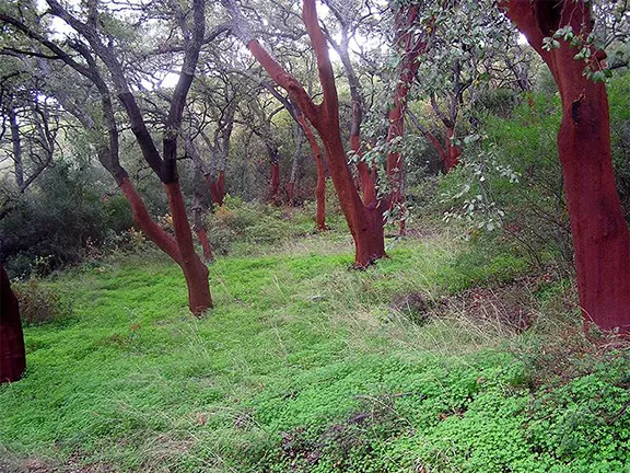 Vulture Restaurant
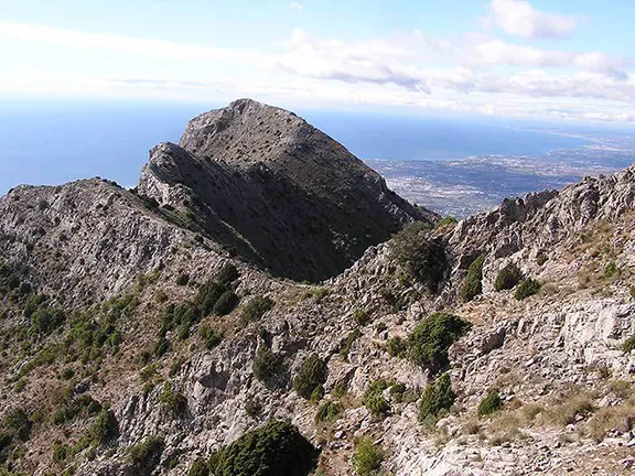 Ascent of La Concha