The Bedar mine walk is through a mining landscape that was alive during the last part of the 19th century and the first half of the 20th
By Nick Nutter | Updated 13 Sep 2022 | Almería | Walking |
Login to add to YOUR Favourites ![]() or Read Later
or Read Later

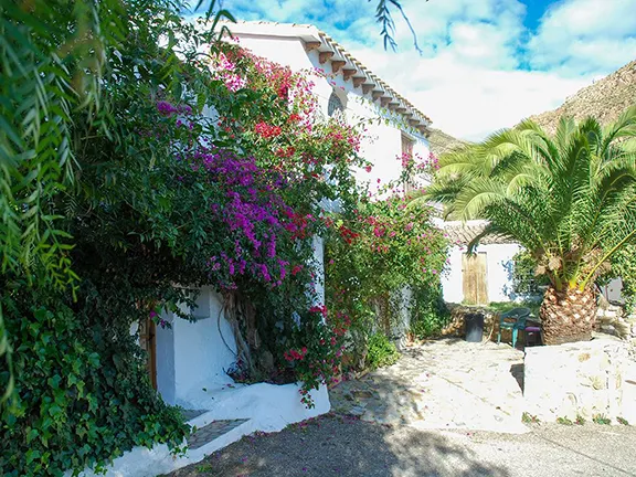
Bedar Mine Walk
The hills and valleys surrounding Bédar are studded with the ruins of mine workings, evocative remains of another age. Some of the mines were one-man affairs, literally one man with his pick and shovel working one concession with a pannier basket and a donkey if he was lucky. Others were owned by corporations that could afford to invest in or share the costs of the infrastructure that allowed more efficient extraction and transportation of the ore. The landscape is dotted with the remains of that infrastructure from narrow gauge railway tunnels to pillars that once supported the cables of the aerial cableways that took ore out of the mountains, down to the main railway line, or one notable exception, from Bédar all the way to Garrucha, the longest aerial cableway in Spain. This walk is through a mining landscape that was alive during the last part of the 19th century and the first half of the 20th. It is well marked with wooden posts marked SL-A 77 with green and white stripes.
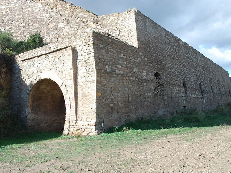

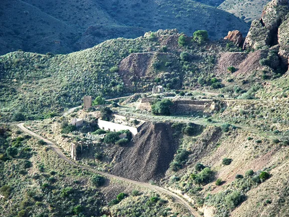
Cargadero Tres Amigos
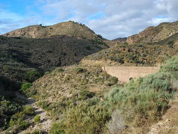
The walk starts on the AL 6109, 1.5 kilometres south of Bédar. You will see a stone-built structure to the west, set back from the road. It resembles a purpose-built railway tunnel with an arch at each end. This is exactly what it is. Ore from the mountains arrived at the Cargadero Tres Amigos by a combination of methods, via narrow gauge railway, aerial cableway, inclined plane (the remains are behind the cargadero), and donkey cart. It was loaded into hoppers. Trains hauling ore wagons would roll into the cargadero. Chutes from the hoppers delivered the ore into the wagons. From there it trundled off on a narrow-gauge railway to the blast furnaces at Garrucha.
Park near the cargadero and walk past it towards Bédar (north). After a few metres the track turns left and winds up the hill. Part of it is on the course of the inclined plane. At the top go straight ahead on to a more level section. This is the route of the narrow-gauge railway line that went all the way up the valley to the Santa Catalina mine. The ruins on the left-hand slope of the valley are those of a small mine called Mina Pobreza that was fairly typical of the medium size mines in the area. The mine was owned by the Compagnie d'Aguilas and started operations in 1871. It employed fewer than 20 people and extracted less than 30,000 tons of iron ore per year in the form of goethite, siderite and hematite. It was worked until 1970.

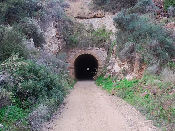
Tunel Servalico
We soon reach the 200 metre long Túnel del Servalico. Walk through the tunnel. About halfway down, on the right is the chute that led to the tiny Mina Alerta on the hill above, down which the miners could shovel the ore directly into the ore wagons below.
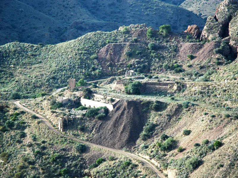
San Manuel Mine
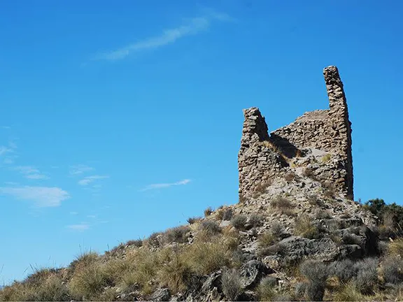
Leave the tunnel and walk on up the marked path ignoring any paths to left or right (which are marked with a green and white cross on posts). The stone building on your right is the engine shed. You will emerge in the Baeza Barranco with fantastic views of the ravine and San Manuel mine, far below. This was an open cast mine that has an impressive list of minerals attached to it: galena (lead oxide), siderite (iron carbonate), barite (barium sulphate), cerussite (lead carbonate), bournonite (lead, copper and sulphur), ferberite (iron tungstate), sphalerite (zinc sulphide), jarosite (potassium iron sulphate), malachite (copper carbonate hydroxide), azurite (copper carbonate hydroxide), quartz (silicon oxide) and native silver. The minerals were taken almost 20 kilometres to Garrucha via an aerial cable. (I think this was the aerial cable referred to in the records as the longest in Spain.)
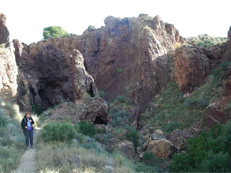

Via Vulcana
From the San Manuel mine bear right and take the tunnel. It is only a short passageway but descends to 1.5 metres so, watch your head. You emerge in an alien landscape of boulders and raw outcrops. At some time during the mining operations this section, a confluence of several mine adits, has collapsed, possibly due to the criss crossing adits, some of which are still visible, cut into the rock with little thought for leaving supporting buttresses or supported roofs. It may also have been caused by uncontrolled blasting. I heard an anecdote over in Las Herrerias to the effect that the foreign mining companies tended to conduct their blasting operations at a set time, normally at the end of a shift when the mines were empty of workers. The Spanish however had a more laissez-faire attitude. It was customary for the fuse to be lit at any time of day or night. A cry of ‘fuego en el hoyo’ sent everybody within hearing scampering for a safe place before the charge exploded. Strangely enough the path gained the name of ‘Via Vulcana’.
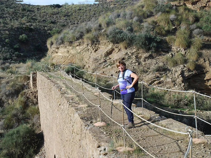

Barranco de los Lobos
Via Vulcana deteriorates into a narrow path on the side of the steep hill with a fair drop on the left so be a bit careful. Wooden sleepers underfoot tell us we are still on the narrow gauge railway line although part has washed down into the barranco and part has been retaken by the hill. Two shorter tunnels take us to another set of hoppers that fed ore from the Vulcana mine to the rail line. The route then crosses the Barranco de los Lobos on a narrow bridge that has guard ropes.

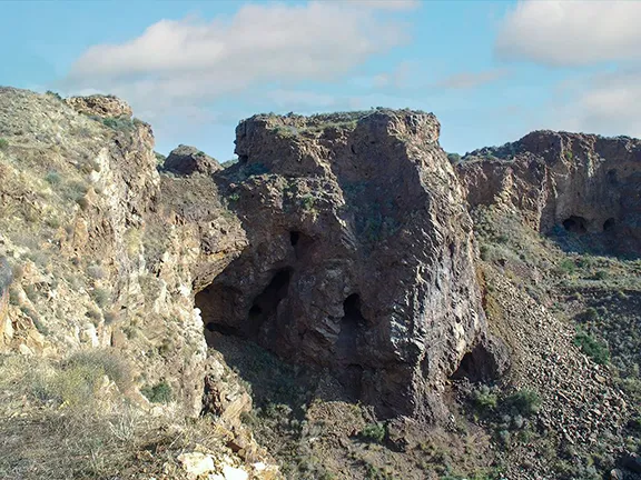
Hoyo Jupiter
Carry straight on as the path winds up the hill. You come to a sign, ‘Hoyo Jupiter’ pointing off to the right. This diversion off the route is worth taking, it is only a few metres before you find yourself on the upper edge of a huge chasm, the Jupiter Mine. This mine was owned by Hierros Garrucha -Minas de Bédar SA. and was very productive. At its height it employed 850 people and produced (in 1895) 17,500 tons of iron ore per year (this is the figure from one mine within the Jupiter orbit. There were six individual mines in total). It was worked until 1972. Notice the striking colours of the exposed rock from deep rusty red to the crisp white of dolomite.

Fuente de Serena
Walk through the village, past the public fuente and about half a kilometre to a nondescript concrete building on you right where you will see a track leading off down the hill. The track winds down into the valley and soon brings you out just south of the first tunnel you walked through. An easy downhill walk takes you back to the car park.
© Visit-Andalucia 2015 - 2024
 Aljambra Tower walk
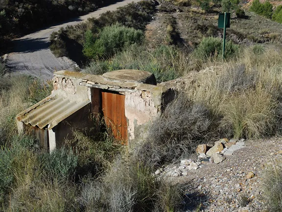 Los Camarates Aljibe walk
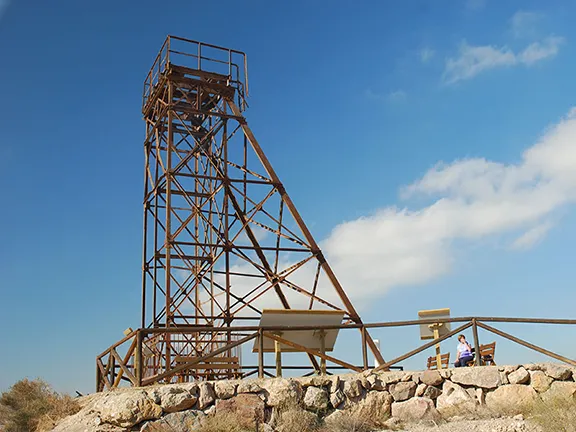 Ruta de Luis Siret