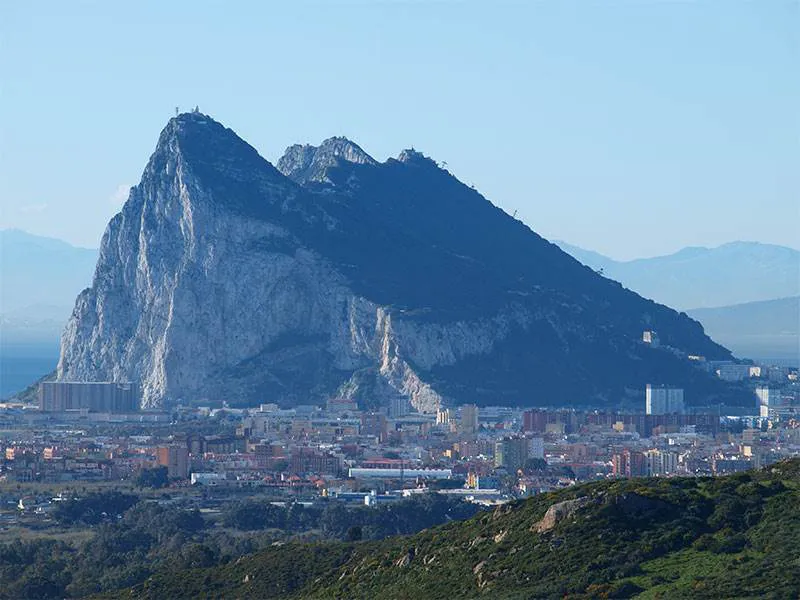
Gibraltar has more history, geography, geology and culture packed into its 6.8 square kilometres than any other place on earth. Officially Gibraltar is a British Overseas Territory located on the southern end of the Iberian Peninsula at the entrance of the Mediterranean and shares its northern border with the Province of Cádiz in Andalucia, Spain.
By Nick Nutter | Updated 28 Aug 2022 | Gibraltar | Cities |
Login to add to YOUR Favourites ![]() or Read Later
or Read Later

Gibraltar
Throughout history people have had something to say about Gibraltar. My favourite is that by Richard H. Davis (1864 - 1916), an American journalist, who wrote, ‘I am now in Gibraltar. It is a large place and there does not seem to be room in this letter, in which to express my feelings about Moors in bare legs and six thousand Red-coats and to hear Englishmen speak again.’ It has not changed all that much, the odd red telephone box with impossibly heavy cast iron and glass door, red pillar boxes and policeman wearing proper helmets have appeared since Davis's day, along with Burger King, but Gibraltar has a unique way of extolling the old whilst embracing the new. You will have to go there to see what I mean.
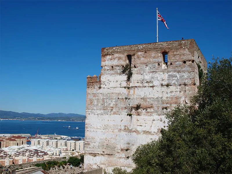

The Homage Tower, Gibraltar
And what a history it has had. It has been occupied by Neanderthals, Iberians, Romans, Visigoths, Moors, Spanish and the British. It has suffered fourteen recorded sieges and one separate peacetime blockade (1969 – 1985). Its population has been totally evacuated once, during the Second World War. On two occasions the majority of the population has been expelled or encouraged to leave, in 1476 (the Jewish component were expelled by the Spanish) and 1704 (the Spanish population were encouraged to leave by the occupying British forces). To their credit, although it caused the Spanish to claim, as they still do, that they had abrogated the Treaty of Utrecht, the British ignored a clause in the treaty, ‘ Her Britannic Majesty (Queen Anne), at the request of the Catholic King (Philip V), does consent and agree that no leave shall be given, under any pretext whatsoever, either to Jews or Moors to reside or have their dwellings in the said town of Gibraltar.’
Each event has left an indelible mark on Gibraltar expressed in its architecture and culture.
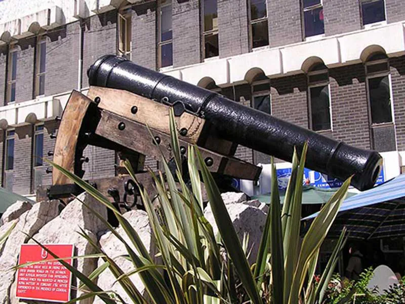
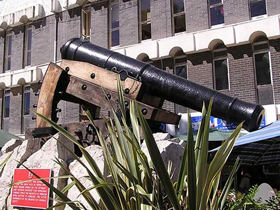
Koehler's Gun, Casemate's Square, Gibraltar
Times of hostilities often spark innovative ideas to solve particular problems and the Great Siege was no exception. In 1782, Lieutenant George Frederick Koehler designed a gun carriage to solve a particular problem. Gunners high on the Rock had the advantage of height and therefore range but they could not depress the guns far enough to shoot at attackers close in to the rock. The depressing gun carriage allowed this in a practical and innovative way. The gun itself was fixed to a sliding carriage which allowed the gun to recoil upwards whilst the carriage itself remained fixed. Koehler’s second innovation was to attach the sliding bed to the carriage with a vertical spindle. This allowed the bed to rotate to the side to allow the gunners to reload without being exposed to enemy fire. One of Koehler’s guns has been restored and is now mounted in Casemate’s Square.

Ceremony of the Keys, Casemate's Square, Gibraltar
It's street and place names echo Gibraltar’s time as a garrison town, Line Wall Road, Castle Street, Rock Gun Road, Flat Bastion Road, Casemates Square, and the period of Moorish occupation, Tarik Passage. Prominent features could have been named by Arthur Ransome, Windmill Hill, Spy Glass Hill, Signal Hill, Camp Bay and Sandy Bay. You will sometimes hear the term Fortress Gibraltar, with good reason.

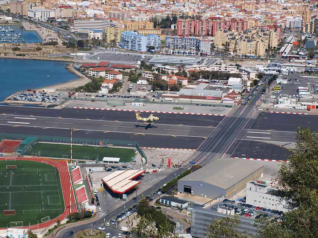
The airfield and frontier at Gibraltar
There is only one road in and out of Gibraltar, Winston Churchill Avenue, and the Rock itself is fairly distinctive, being a 426 metres high lump of limestone sticking up at the end of a low lying isthmus, so it is hard to miss although in February 2002 a party of Royal Marines from the helicopter carrier, HMS Ocean, practising a dawn assault, stormed ashore on the San Felipe beach at La Linea from a landing craft with 60 mm mortars and SA80 assault rifles. They took up defensive positions on the beach ready to face a force of fellow British soldiers pretending to be the enemy. Startled local fishermen called the police. Two uniformed officers from La Linea’s municipal police force duly arrived and informed the detachment that they were not, as they had thought, in Gibraltar. Before they could be asked for passports the marines beat a hasty retreat and went off the find the real Gibraltar.

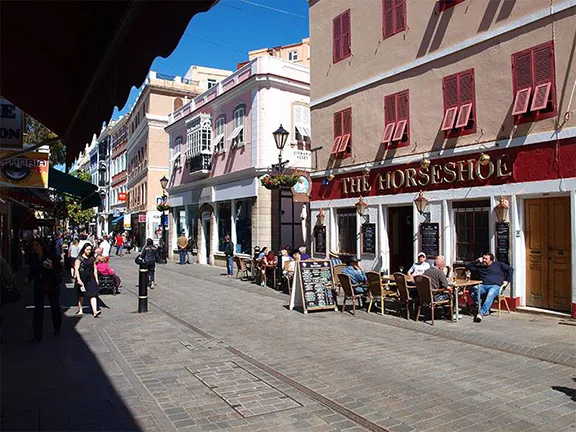
Main Street Gibraltar
We are going to enter Gibraltar in a more conventional manner by showing our passports and crossing the frontier. It is impossible to point out all the highlights in a short article, books have been written about Gibraltar, so this will be a whistle stop tour to wet the appetite.
The first feature you will notice is the airfield. It is one of a few in the world with a main road crossing it controlled by traffic lights and barriers a la railway level crossings. Its second unique selling point is the vertical north face of Gibraltar that actually borders the airfield and its third is its extremely short runway, 1800 metres with sea views at both ends.
It regularly appears in lists of the top ten scariest runways in the world.
It was built during World War II on the site of the Gibraltar racecourse. At the same time tunnels were being excavated in the Rock to provide a hospital, munitions dump, water and fuel reservoirs, and radio communications posts together with road communication between various military points. This was done in secret, the spoil from the tunnels was brought out at night and used to extend the runway.
You can visit the wartime tunnels, it is an unforgettable experience.
If you look up at the Rock whilst crossing the runway you will see a number of holes. During the Great Siege, (1779 – 1783) a tunnel was dug by hand into the Rock and the ventilation holes became very useful gun ports. Visitors to the Upper Rock can pay to walk through the tunnels and galleries.
Still looking up you will notice a stone tower with the Union Flag proudly flying from a mast on the top. This is the Homage Tower and dates back to the Moorish occupation. The scars in its walls are as a result of missiles thrown at it during succeeding sieges, first stones thrown by siege catapults, then stones emitted by gunpowder fuelled cannon and finally metal cannonballs and mortars. You can visit the Homage Tower.
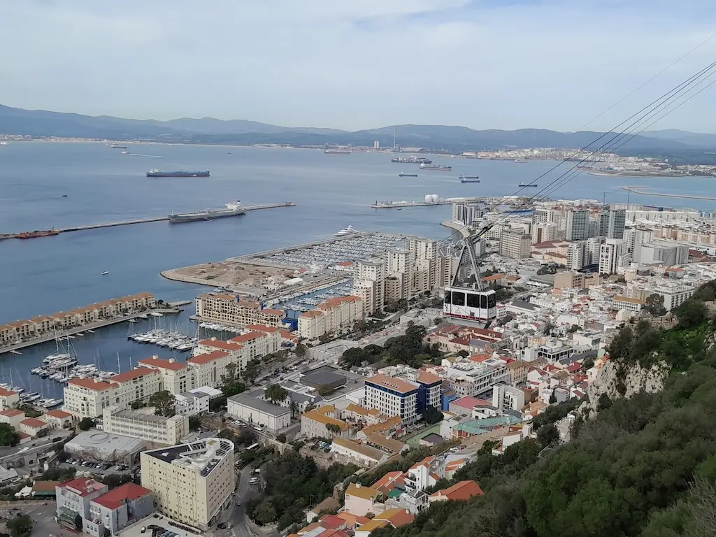
Once across the runway you enter the new part of town. To your right is the Ocean Village Marina and high rise apartments, all built on land reclaimed from the sea. Reclamation started in the late 19th Century and goes on today.
Within the marina complex there is the Admiral Casino. In addition to a restaurant, bars and gaming rooms, there is a balcony from which you can see the sun set whilst watching the last flights of the day arrive at Gibraltar International Airport. The Casino is also the home of Monkey Bingo. I have never worked out if that is a type of bingo game or a tongue in cheek reference to the Barbary macaques that inhabit the Upper Rock and often skirmish into the town itself.
You will also see, moored alongside the casino, the Sunborn Gibraltar Yacht Hotel. This 5 star, floating hotel, arrived in 2014.
As you approach the older part of town you will start to see the massive fortifications that surround Gibraltar. Built on walls founded during the Spanish occupation ( 1462 – 1704), they are now primarily the legacy of Britain’s occupation after 1704. The main defensive wall is Line Wall and that runs all the way from the northern part of the defences, North Bastion, down the western side of the town as far as South Mole. Line Wall has a number of Bastions, fortified positions, built into it.
There are a number of gates through which you can enter the old town itself, the first two are for pedestrians only and both take you into Casemates Square, the social hub of Gibraltar with bars, restaurants and shops.
Landport Gate was originally the only gate into Gibraltar and is situated at the northern end of the town. It was rebuilt in 1727 and takes you through the depth of the defensive walls. By the end of the 18th Century there were five gates that gave access to the town, Landport, Chatham Wicket, Waterport, Southport and Prince Edwards’ Gate.
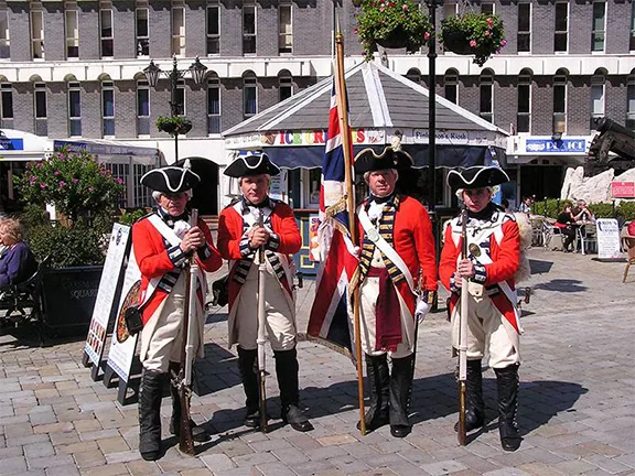
During the 18th and 19th Centuries, every evening, at sunset, the Governor of Gibraltar would relinquish the keys to the four gates, Landport, Chatham Wicket, Southport and Prince Edward’s that gave access to the old town and garrison, (Waterport was fronted by the sea although I am pretty sure it was kept locked at night), to the Port Sergeant who, with his escort, would lock each of the gates. He would then return the keys to the Governor. In the morning the process was reversed to open the town. Each Saturday morning a group of volunteers re-enact the Ceremony of the Keys in period costume and can be seen on Main Street.
Chatham Wicket no longer exists. It was in fact a drawbridge that gave access to the Old or North Mole from Chathams Counterguard, the entry through the counterguard is now cemented up. During the Great Siege the guns on that mole gave the Spanish such a hard time they, the Spanish, called the mole Devil’s Tongue. The mole followed the line of Waterport Road
Following Line Wall the third gate encountered is Waterport in the north western side of the defences. It penetrates Line Wall. As the name suggests it gave access from Casemates Square directly to the sea before the land was reclaimed. It has now been renamed Casemates Gates and consists of three gates, one opened in 1727, the second in 1859 and the third in 1884.
Line Wall continues past King’s Bastion, now a family activity centre with bars, restaurants, cinema, bowling alley and skating rink.
Following Line Wall down the western side the next gate to appear is Ragged Staff Gate. The first gate was cut through Line Wall in 1736 and gave access to Ordnance Wharf. Two further pedestrian gates were constructed in 1843 and 1921. Pass through Ragged Staff and to your left is Charles V Wall. Ragged Staff Gates are therefore outside the defensive perimeter of the old town formed by Line Wall to South Bastion and Charles V Wall.
Charles V Wall was constructed in 1550 and helped protect Gibraltar from the Barbary pirates who had taken to raiding the town for booty and slaves. The wall runs from South Bastion, which was at the water’s edge in 1550, to Prince Edward’s Gate which is at the foot of a cliff, part way up the Rock. Prince Edward’s Gate dates from 1790. The upper section of the wall runs from the top of the cliff a little further south in a zig zag to the summit ridge. Today you can walk up the wall just as the defenders could in the 16th Century. Still looking up at the Rock you will see another wall running from the top of the cliff above the first section of the Charles V wall. Originally thought to have been build by the Moors, it was known as the Moorish Wall. However more recent research reveals that it was built during Phillip II’s time, around 1575, as a further defensive measure to support the Charles V wall. It is sometimes now known as Philip II Wall and to confuse the issue even further you will sometimes hear it called by the name it was known during the Spanish period, the Muralla de San Reymando. On the summit ridge above the Moorish Wall there was a signal station with a small tower that has now gone.
Inset into Charles V Wall between South Bastion and Flat Bastion are a set of gates that were originally called Africa Gate, together now known as Southport Gates. The first two were built in 1552 and 1883, the third and widest gate is Referendum Gate and that was opened in 1967.
Just to the east of Southport Gate, on the outside of the Charles V wall and beneath Flat Bastion is the Trafalgar Cemetery. Consecrated in 1798, the cemetery was then called Southport Ditch Cemetery and it was only in use until 1814. Despite its current name only two of the graves belong to men who fought at the Battle of Trafalgar, Captain Thomas Norman of the Royal Marine Corps serving on HMS Mars and Lieutenant William Forster serving on HMS Colossus.
From the Trafalgar Cemetery it is a short distance to the Cable Car that takes you up to the top of the rock. Once at the top you will find, open to the public, within walking distance, the Homage Tower, Second World War tunnels, Great Siege Tunnels, Apes Den and St Michael’s Cave. At the time of writing (March 2015) the ‘City Under Siege’ Exhibition was closed for renovations.
Back at ground level there is still plenty to see. Just south of the Cable Car Station are the Alameda Gardens. Lieutenant Governor George Don instigated the gardens in order to provide a scenic walk for visitors and residents. They were opened in 1816. In addition to a host of Mediterranean plants there are some endemic to Gibraltar in a special bed near the cafe. There is also an African bed and an extensive cactus garden.
Further south, mounted at Napier of Magdala battery is the 100 ton Gun or Rockbuster. Built by the Elswick Ordnance Company in 1882 it was one of the largest guns of its time. Weighing in at 103 tons and firing a shell weighing 2000 lbs (910 kg), the gun had an effective range of 6,500 yards and a claimed maximum range of 8 miles although it probably never achieved more than five miles (8,046 metres). It required a steam engine to traverse and elevate the weapon. It took 30 minutes to raise steam and 35 men to crew the engine and gun. The battery is now an exhibition centre, well worth a visit.
Finally, at the very southern tip of Gibraltar you will find Europa Point. At longitude 36.10 North it is just pipped for the title of most southerly point of mainland Europe by the Punta de Tarifa (36.00 North) a few kilometres west.
Punta de Tarifa however does not have a mosque which makes the grandly and eloquently named Ibrahim-al-Ibrahim Mosque, also known as the King Fahd bin Abdulaziz al-Saud Mosque or the Mosque of the Custodian of the Two Holy Mosques, the southernmost mosque on the European mainland. It was opened in 1997 and was a £5 million gift from King Fahd of Saudi Arabia. Facing south towards Morocco it is a powerful symbol for the 1000 or so Muslims living in Gibraltar.
On the flat area on top of the cliffs at Europa Point you will find a large children’s play/adventure area, a cafe, Europa Point lighthouse, the Shrine of Our Lady of Europe and Harding’s Battery that has been restored and in which there is a small exhibition set up in the magazines below the gun mounting.
During the 16th Century it was traditional that mariners passing Gibraltar would fire a cannon in honour of Our Lady of Europe, a statue that was housed in the Shrine of Our Lady of Europe. The shrine was originally a mosque, built during the Moorish occupation in the first years of the 14th Century. It was turned into a Christian shrine after the final Spanish conquest of Gibraltar in 1462. The small statue of the Virgin seated with the Child Jesus on her lap was installed in the shrine in the 15th Century. Mariners would often come ashore with gifts for the shrine, echoing a Phoenician practice some two thousand years previous, and supplies of oil for the lamp that burned in the tower above the chapel. The shrine became Gibraltar’s first lighthouse.
In 1540 Gibraltar was raided and looted by Barbary pirates. The town and the shrine were sacked but the pirates respected the statue and left it behind, although every other valuable in the shrine was taken. The statue was not so lucky in 1704 however. British soldiers looted the shrine and broke off the head of the Virgin and threw it into the Strait. The wooden head floated into the Bay of Gibraltar where it was found by a Spanish fisherman. He delivered the head to Juan Romero de Figuero, the priest in charge of the parish church of St. Mary the Crowned. Juan smuggled the statue with its detached head to Algeciras where it was repaired and housed in a small chapel that was then named the Chapel of Our Lady of Europe.
Meanwhile the shrine and every church on Gibraltar, apart from St Mary the Crowned which later became the Roman Catholic Cathedral, had been taken over by the military. During the Great Siege the shrine was so badly damaged that it had to be demolished and subsequently rebuilt. The structure you see today is the ‘new’ shrine. In the early 1860’s the Vicar Apostolic of Gibraltar petitioned for the return of the original statue from Algeciras. Surprisingly, in 1864, it was returned. The shrine was still in military hands so the statue had to be kept in a new chapel built on Engineer Road. It remained there until the Second World War when it was removed to the Cathedral for safekeeping. After the war the statue was again on her travels, this time to St. Joseph’s Parish Church which was the closest church to Europa Point.
In 1961 the shrine was ceded to the Diocese by the military authorities. Following restoration work the shrine re-opened for mass in 1962. Finally on the 7th October 1967 the statue was taken in a public procession, from St. Joseph’s back to her place in the shrine.
Main Street, now pedestrianised, is the place to go for duty free shopping. Perfumes and unguents, jewelry, gold and silver, watches, leather goods, wines, spirits, beer and cigarettes and much more can all be had from the shops lining the street, all constructed within fine, colonial style buildings.
Morrison's Supermarket is a short walk away near the cruise liner terminal and a new Eroski supermarket greets you as soon as you pass through the frontier.
There is no shortage of pubs, bars, cafes and restaurants. If you fancy English style pubs with English beer then walk up Main Street or adjacent Irish Town and the streets that lead from them. Most serve food; fish, chips and mushy peas, bangers and mash, chicken and chips, burgers, in fact just what you would expect in an English pub. Sports bars and slightly more upmarket restaurants can be found in the old Marina and the rather newer, Queensway Quay Marina. In the side streets you will find Chinese, Indian, Italian, Turkish, Moroccan and other take aways and restaurants serving food from many nations, reflecting the cosmopolitan nature of the Gibraltar population.
Homer (c 850 BCE) – ‘A small rock holds back a great wave’.
Abd-ad-Mummin (1159) in a letter to his son, Abu Said Utman, the Governor of Granada – The sovereign informs his correspondents that, although he is engaged on the jihad in the east of North Africa, he has not forgotten about the problems of al-Andalus, and that he has decided to build a city on Gebal-Tariq, which is situated in the junction between the Mediterranean and the Atlantic and is central for both sides of the Straits; he proposes to endow this foundation with all kinds of advantages and to make it invulnerable.
Isabell of Castile (1504) – ‘I ask and require of the Kings, my successors, that they hold and retain the said city (Gibraltar) for themselves and in their own possession’.
George Augustus Elliot (1781) – ‘Look round my boys and view how beautiful the Rock appears by the light of the glorious fire.’
Jebediah Tucker (1838) (Lord St. Vincent’s biographer) – Gibraltar is a place which Englishmen ought to know and to revere. It affords at once a monument of her past deeds and proof of her present power.’
Richard H. Davis (1864 – 1916) – ‘I am now in Gibraltar. It is a large place and there does not seem to be room in this letter, in which to express my feelings about Moors in bare legs and six thousand Red-coats and to hear Englishmen speak again.’
Channing Pollock (1880 – 1946) – “Each generation produces its squad of ‘moderns’ with peashooters to attack Gibraltar”
Dwight D. Eisenhower (1942) – ‘Britain’s Gibraltar made possible the invasion of North West Africa. Without it the vital air cover would not have been quickly established on the North African fields’
Queen Elizabeth II (1954) – ‘We shall go forward in the future partnership and in amity for the good Government and sure safe keeping of Gibraltar’.
Nigel Short (Chess Player) – 'Well, Gibraltar is a place which you either love or hate. I quite like it. It’s a rock, that is essentially what it is. It’s a British colony.'
Field Marshal Sir John Chapple (Governor of Gibraltar 1993 – 1995) – ‘probably the most fought over and most densely fortified place in Europe, and probably, therefore, in the world’
Michael Ancram (2004) – ‘This is a very important moment in Gibraltar’s history, 300 years of being British, which is rather longer than it was ever Spanish’.
© Visit-Andalucia 2015 - 2024
 Best Gibraltar Day Tours
 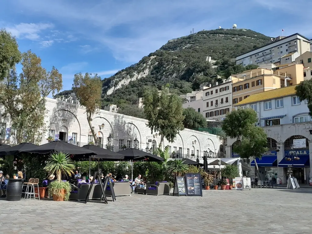 Malaga to Gibraltar Tour
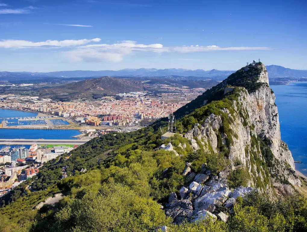 Best Passes, Activities & Tours in Gibraltar
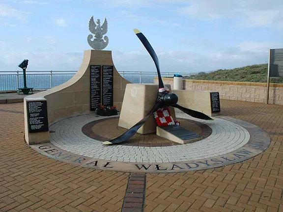 General Wladyslaw Sikorski Memorial
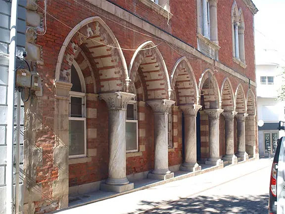 Irish Town
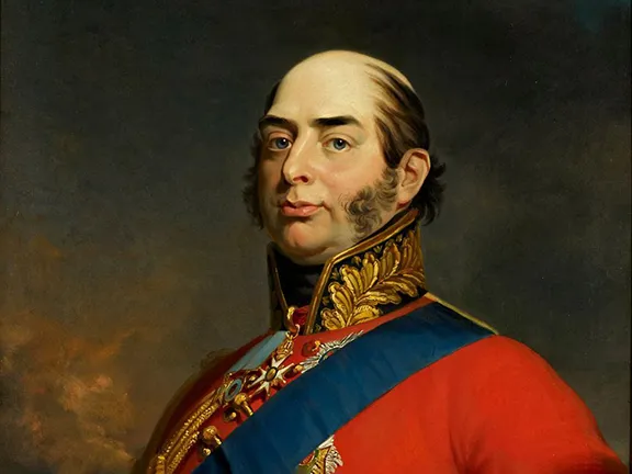 The Duke of Kent and His House
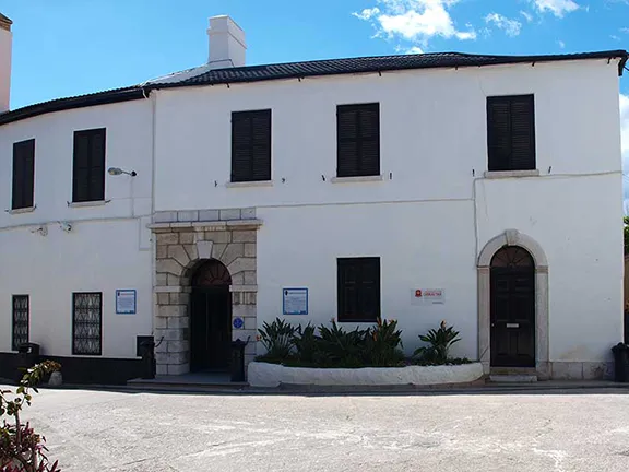 National Museum