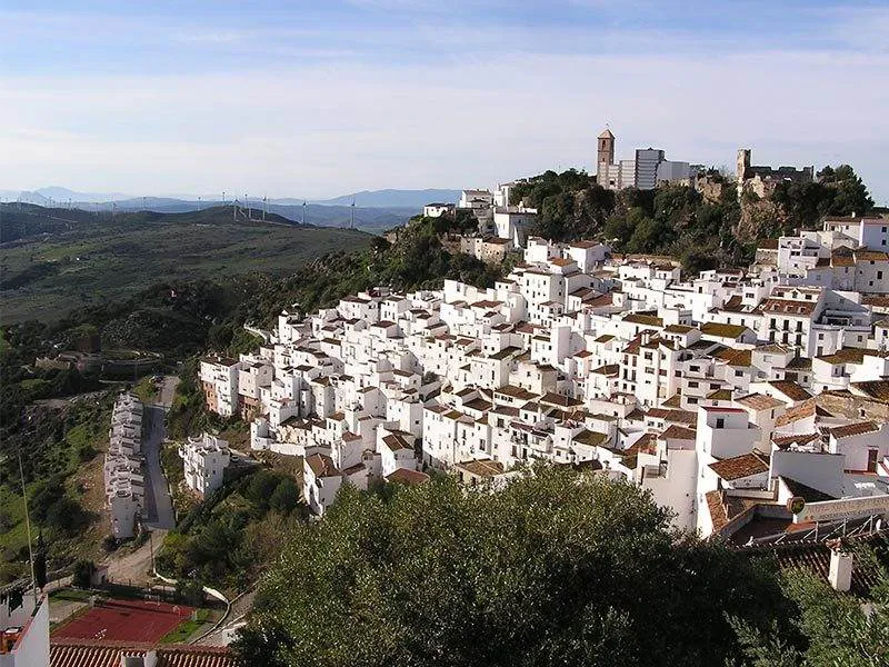
Casares is 14 kilometres from the Costa del Sol coast and a favourite spot for artists and photographers.
By Nick Nutter | Updated 29 Aug 2022 | Málaga | Villages |
Login to add to YOUR Favourites ![]() or Read Later
or Read Later
Casares
Casares is much more than ‘just another Andalucian white village’ it is a municipality in its own right with far more too it than first meets the eye. Once much larger, it lost what is now the municipality of Manilva in the 16th century, a matter that still causes rancour, it still extends over a considerable area stretching from the coast at Marina Casares in the south to 4 kilometres north of Crestellina and from the Rio Genal in the west to the Sierra Bermeja in the east. Encompassed in this area is fertile land, fed year-round by runoff water from the mountain of Los Reales, that forms a depression out of which the rocky buttress with the village of Casares clinging to it like a limpet, rises and in the surrounding hills there are once rich mines that provided iron ore and silver.

Torre del Sal
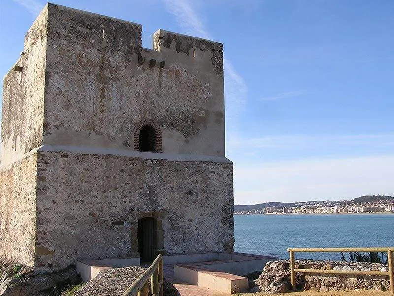
Not surprisingly its attributes have been recognised since prehistoric times. Bronze age artefacts have been found in the limestone caves in the Utrera Gorge and the first permanent settlement dates back to Iberian times. The best way to appreciate Casares is to take a tour so, like many explorers we shall take our first view of Casares from the coast where our introduction to the area is the imposing Torre de la Sal.
Torre de la Sal
The torre stands square built on a rocky promontory at the north end of the long beach that extends from the modern marina of Duquesa and marks the end of Sabinillas Bay. Older than many of the coastal torres that were built after the reconquest to warn of raids by Barbary pirates, Torre de la Sal dates back to Moorish times. Between 859 and 971 AD Vikings, the same Vikings that raided the islands of Great Britain, arrived in their longboats after an arduous voyage from Scandinavia and plagued the Iberian peninsula from Cadiz round to Malaga and beyond. In 859 they sacked Algeciras and burnt its mosque. The torre was then in continuous use as a lookout for Byzantine raiders from North Africa until the reconquest when it was again a valued component of the string of torres built to warn of pirates. It saw duty right through the Peninsula War, the Carlist Wars and the Civil War after which it became a Guardia Civil barracks until the 1950s. Abandoned then for fifty years it fell into disrepair but in 2009 it was restored and is now refurbished and once again looks the part. Happily, its role now is a tourist attraction and a splendid venue for wedding parties.

Casares
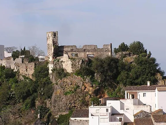
Moving inland past the ‘pepperpot’ a much more modern torre, the road follows a ridge with Dona Julia Golf Course in a valley to the left. It then wends its way into the foothills of the Sierra Bermeja with the towering mass of Los Reales on the right and magnificent views of the Mediterranean. Dramatically, round a hairpin bend, Casares is suddenly there ahead of you. The view from the west side is the most spectacular, little wonder there is a viewing point and a couple of ventas from which you can drink in the vista, and other refreshment if you so wish.
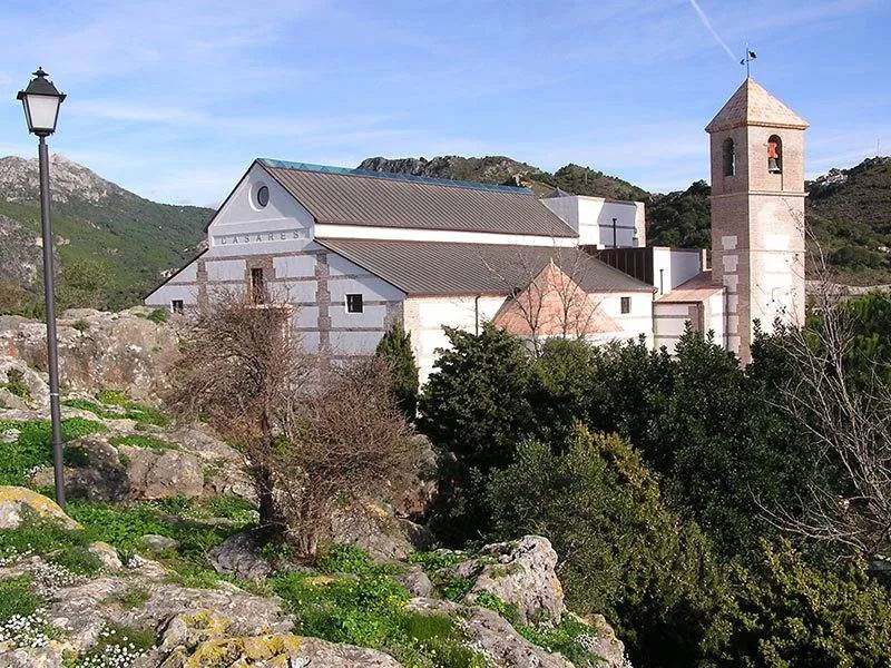
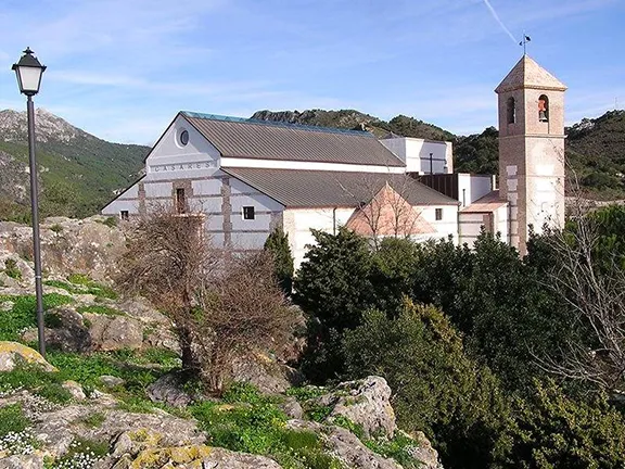
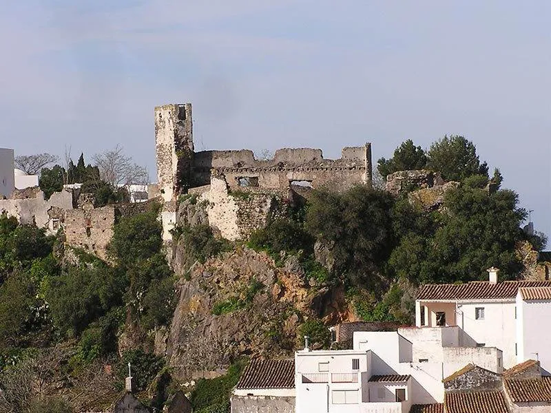
Iglesia de la Encarnacion
Dominating the village on the crest of the rocky bastion is the 16th-century church of Iglesia de la Encarnacion that is probably built on the foundations of a mosque used by the original occupiers who, following the invasion in 711, were North African Berbers rather than the more prevalent Arabs. They were a peaceable people who integrated with the existing Hispano-Visigothic population who pragmatically agreed to pay an annual ‘tribute’ to the settlers and carry on as if nothing had changed. The previously unnamed rocky outcrop became an important administrative centre and soon had a fortification, an Alcazar, with the mosque inside. Not much of the Alcazar survives apart from the foundations and some parts of a wall up to about 1 metre high. The walls you see today were built in the 16th century on top of the by then ruined original and they in turn, along with the church, were severally damaged during the 20th century Civil War.
Blas Infante
A macabre reminder of those days may be seen in the ruined Hermitage of Vera Cruz alongside the church. The standing domed structure was the altar room. In the three remaining walls, you can see what look suspiciously like bullet holes, whitewashed over in an effort to hide them and then barred off by an iron gate to prevent access. Looking north to the next hill you will see the ruins of a second, smaller fortification built by the Moors to guard the northern approaches to the village. Protected by the Alcazar the white-painted houses of Casares tumble down to the foot of the hill.

Lacipo
Casares was seized from the Moors in 1484 and once again the inhabitants shrugged and simply continued their old way of life. It was not until 1491 that the Moors were dispossessed and restricted to the surrounding Serrania. The population of Casares was augmented by people from Gibraltar, Jimena and Tarifa and the town remained prosperous until 1570 when the frustrations of the dispossessed Moors fermented into a revolt. Whilst other villages in the Sierra Blanca fought to the last man Casares was again pragmatic about the whole affair and surrendered. Unfortunately on this occasion pragmatism had no rewards and the rebellious Moors were thrown off the castle walls into the ravine below and their property was divided up between the victorious nobles, friends and allies of the Duke of Arcos.
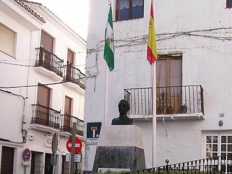
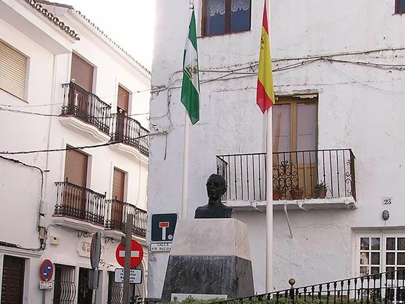
Over three hundred years later, in 1885, Casares gave birth to the Andalucian Nationalist leader Gil Blas Infante who was executed by Franco’s troops at the beginning of the Civil War. His statue stands in the Plaza de Espana in the town and his house on the main Calle Carrera is now the Tourist Office and a museum to his memory. The impoverishment of Casares and the feudalistic local government following the Moorish revolt had fuelled his Nationalistic fervour. It is only in very recent years that Casares has emerged from four hundred years of grinding poverty.
As you leave Casares, on the left about 1/2 a kilometre outside the village is a new building that will, eventually, open as a Tourist Information Centre (still closed in November 2019). Alongside is a car park. At the back of the car park a path leads to the top of a small ridge and a bench seat. The griffon vultures and occasional assorted eagles, descend the into the valley from the Crestellina ridge to the north. They will often swoop past the observation point at eye level.
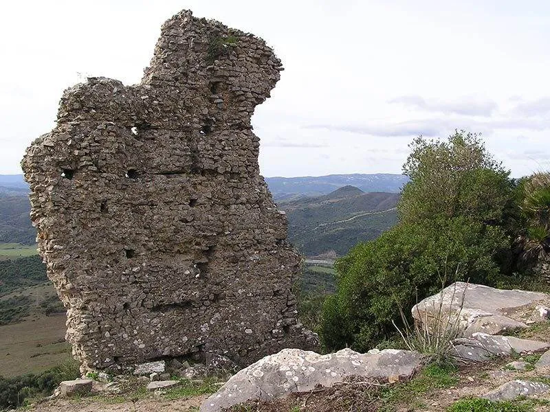
Continuing our voyage of discovery, follow the road from Casares to the junction with the Manilva to Gaucin road and turn left. In 1.5 kilometres a rough road branches off to the right into the valley of the Rio Genal. Once the main road from Casares to Jimena it is still a passable, though uncomfortable, route. On your right is the steep hill of Cerro de la Pelliscosa and on top of that hill, with a panoramic view across the Genal valley and beyond to Gibraltar are the deserted ruins of Lacipo, the first permanent settlement in Casares.
Lacipo, or Alesipe as it was called when the Romans arrived in the 2nd century BC is reached now, as it was then, by a winding track up the east side of the hill. The oldest part of Alesipe is the western side directly overlooking the valley and almost sliding into it. Carefully crafted stonework, laid without the benefit of cement, have a Turdetanian style for the original inhabitants were the Orientalised Iberians of the Tartessian tribe whose territory extended to the Atlantic at Cadiz and up the Rio Guadalquiver. A massive wall once enclosed the domestic buildings but only the foundations can now be seen. To the north remains of the Roman town and excavations have identified the location of a forum, grain storage pits, water cisterns and steps leading to what is thought to be a temple. A further defensive wall enclosed this area, a ten-metre high section and the foundations of the fortified gatehouse being the only part still standing. All carefully cemented together the Roman remains have not stood the test of time as well as the Iberian.
Within a century of its development by the Romans, Lacipo as they named it, became very prosperous based on the production of olive oil. There are many references to the town in surviving records indicating how important the Romans considered this now largely forgotten place. In the 3rd century, Lacipo became self-governing, a Roman concept that left control in the hands of the local population in return for tributes and taxes to Rome. It was this financial drain that caused the abandonment of Lacipo. The local prominent families experienced increasing financial demands being made by the inflation ridden Roman Empire in the 2nd century AD and about one hundred years later Lacipo became a luxury they could no longer afford. It was abandoned well before the Romans vacated Hispania.
Another source of wealth, exploited since the 3rd century BC, was iron ore. From Lacipo the Romans built a paved road, the Via XIIa to the Cueva del Baque, now in a private estate north of Casares. That road in turn linked up to the Via XII that ran from the coast up the Genal valley to Acinipo, near Ronda. Both roads were part of the network of paved roads collectively called the Via Augusta that took you straight to Rome.
We, however, have not the time to explore the Via Augusta. Our exploration now crosses the Genal valley to Cerro Carretero 5 kilometres west of Lacipo. On top of this hill was a second Ibero-Roman settlement. Very little now remains and it will only be the ardent enthusiast that clambers up the steep, unmarked path to the top. This settlement, along with Lacipo, controlled access to the unpopulated hinterland that was rich in minerals and it is from the top that you understand why the Turdetanians built this much smaller fortified village. From there you can see directly to the Ibero settlement that would become Oba, Jimena de la Frontera and to Gaucin to the north east. They provided a chain of beacons that was used to pass messages between the towns and villages of pre-Roman Andalucia.
Our route now takes us down the rough road alongside the Rio Genal following the road first laid by the Romans. It is probably in a far worse state of repair now than the Romans would have allowed as it takes us out of Casares into the neighbouring Manilva municipality and from there to San Martin and so back to the A7 at Sotogrande. Casares municipality can be explored in one day but on that day you will experience and see over 2,500 years of continuous history. There is far more to Casares than first meets the eye.
© Visit-Andalucia 2015 - 2024
 Roman Baths near Manilva
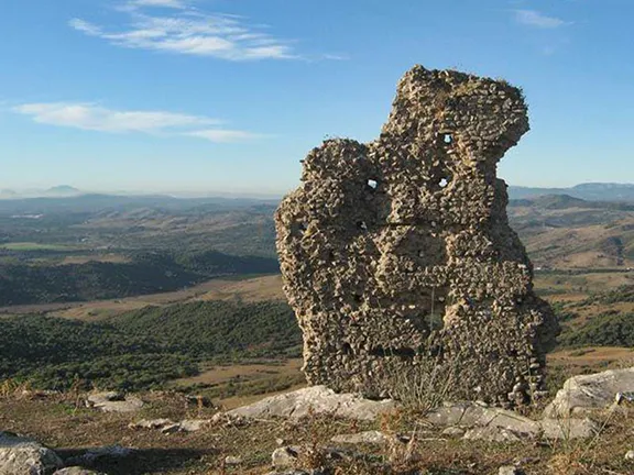 Lacipo
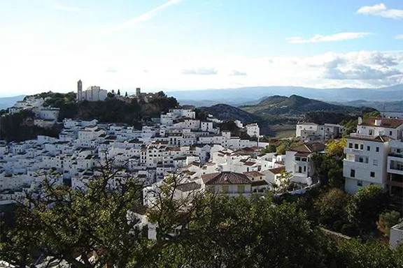 Eagles and Vultures walk
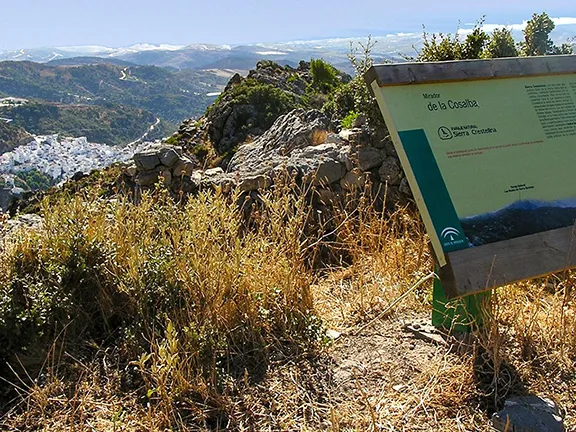 Sierra Crestellina Paraje Natural
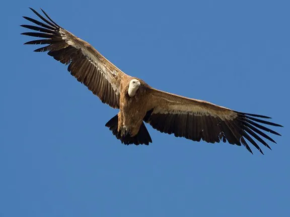 Two old codgers walk up Crestellina