The Pozuelo archaeological site consists of eleven dolmens, a copper mine and a fortified settlement in Zalamea la Real, Huelva province, Andalucia, Spain
By Nick Nutter | Updated 4 Jun 2023 | Huelva | Places To Go |
Login to add to YOUR Favourites ![]() or Read Later
or Read Later
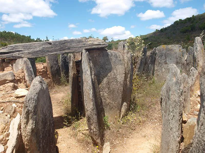
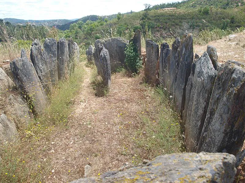
Dolmen 3 Pozuelo
El Pozuelo is a small village within the municipality of Zalamea la Real in the eastern part of Huelva province. Just outside the village is an archaeological complex that consists of eleven dolmens, a copper mine and a fortified settlement. The site is in a wooded area of steep slopes, ravines and numerous streams. The dolmens tend to be situated at the end of short ridges that lead off from the slopes. A forest track with paths leading off gives access to the dolmens.
Strictly speaking the majority of 'dolmens' at El Pozuelo are passage graves or corridor tombs.
Dolmen 3 Pozuelo
Although the site has been known since 1946, the excavations and research conducted there have been uncoordinated until recent years. In 2016 Jose Antonio Linares Catela from the University of Huelva put together the first detailed chronology of part of the site.

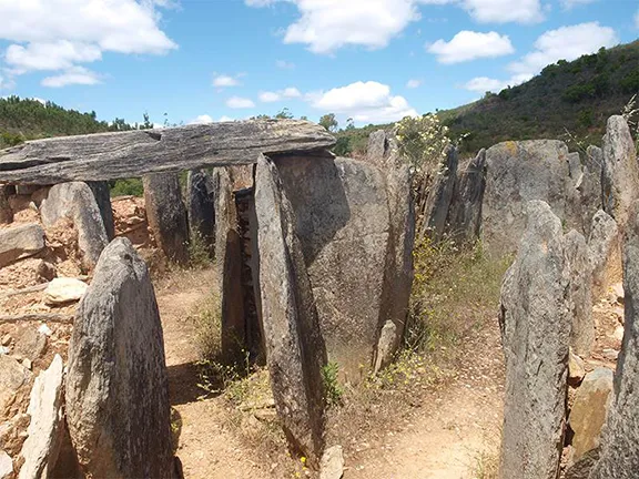
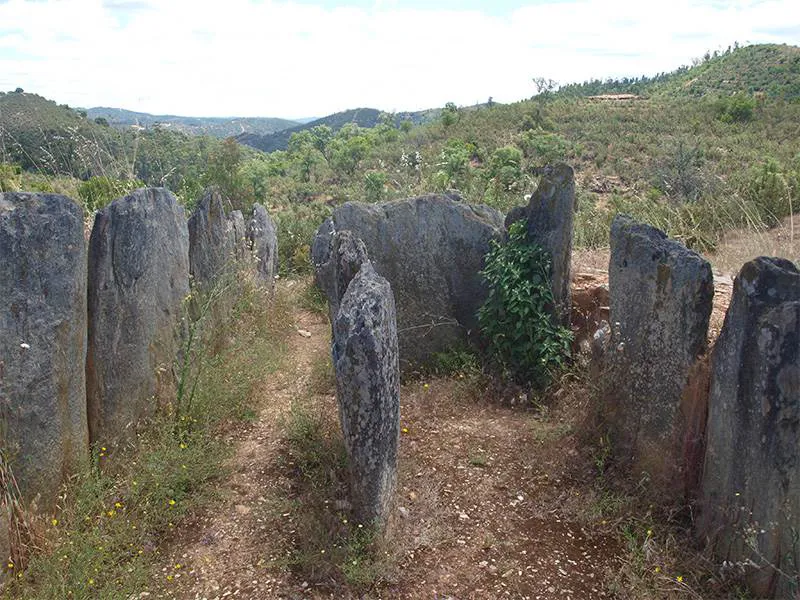
Dolmen 4 Pozuelo
Huelva has a large number of megalithic structures dating from 4000 BC to 1000 BC; standing stones, stone circles, megalithic tombs, tholoi and hypogea. Some of the megalithic tombs are single, huge affairs like the Dolmen de Soto some 30 kilometres south of Pozuelo, whilst others are groups of dolmens. Soto would have involved the collective labour of hundreds of people, in effect a whole tribe, whilst individual dolmens such as those at Pozuelo, were built over a considerable period of time and would involve perhaps a dozen people at each stage to manoeuvre the heavier orthostats and capstones. The people that built the dolmens at Pozuelo were agriculturalists. They lived in small groups scattered about the landscape.

Dolmen 4 Pozuelo
Within the Pozuelo complex, five groups of dolmens have been identified called Los Llanetes, El Veguilla/El Riscal, Los Lomeritos, Los Rublos and Martin Gil. The Los Llanetes group consisting of four dolmens, conveniently numbered 1, 2, 3 and 4, is the subject of the study, particularly dolmens 3 and 4 that were the subject of excavations carried out in 2010.
Los Llanetes is the easternmost group of dolmens. About 450 metres north of the group is a prominent hill that has been identified as a fortified settlement and 650 metres northwest are the Chinflón copper trench mines. The settlement overlooks the whole megalithic complex.
Dolmens 3 and 4 occupy a promontory approximately 65 metres long and between 35 and 48 metres wide. The promontory has been completely worked, to create a stepped site composed of three terraces connected by ramps and all converging on a ditch on the northern side. The terraces are curved and edged by retaining walls and by a knapped slate outcrop. The tombs are at the highest level, built on a supporting platform consisting of the same knapped outcrop, augmented by sandstone walls.

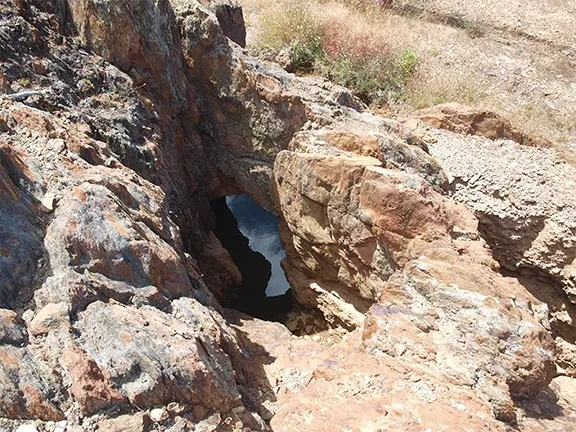
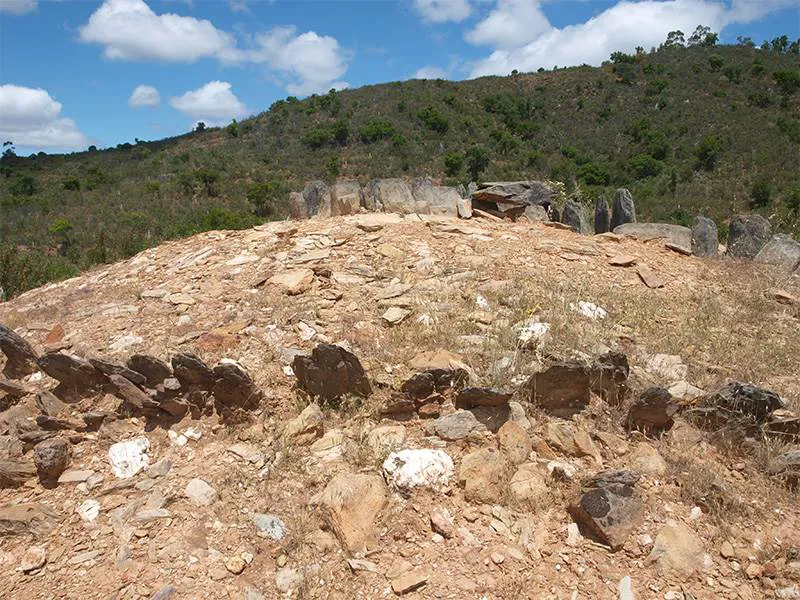
Chinflón Mine Pozuelo
The promontory as originally worked could be considered a sacred space. Sometime around 4000 BC, several stelae were erected in the space now occupied by dolmen 3. They were aligned northwest to southeast, facing the winter solstice. Hearths and small pits were found at the same level.
The stelae are small, long and of varied height and width, about 1.20 metres long and 20 – 40 cms wide. All had fractured bases since some were used later as orthostats or shoring pieces when the tombs were built. This sacred space was used by the Neolithic people of the area for about 500 years.
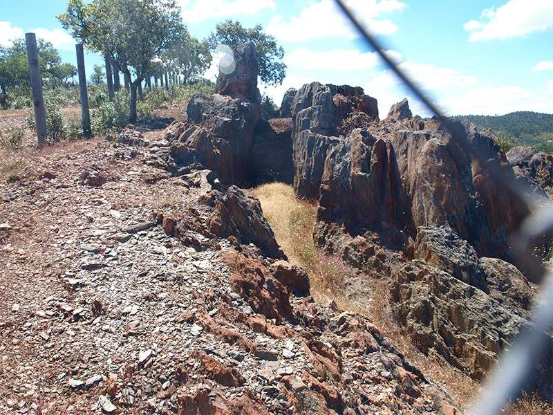

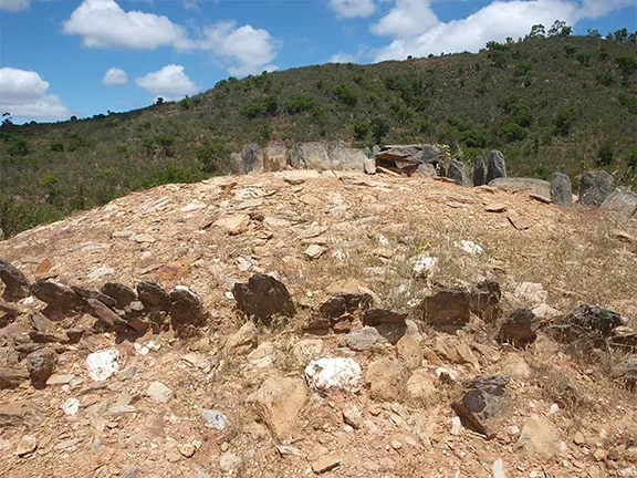
Chinflón Mine Pozuelo
About 3500 BC, rituals surrounding death and ancestors and the need to establish ownership of land became important as the Neolithic population increased. Dolmens were easily identified features in a landscape. The first dolmens were built on the western seaboard of the Iberian peninsula. The custom spread north into Brittany and beyond and east into Huelva province and eventually all the way to the Mediterranean coast in the east. Between 3500 and 3250 BC, Dolmen 4 was built at El Pozuela. The previously mentioned stelae were used to support the capstones over the chamber that measured 6 metres by 2.60 metres. A similar technique was used at Menga dolmen at Antequera. Dolmen 4 also incorporated an anthropomorphic stela with carved round eyes similar to carvings found on plaque idols.
About 3000 BC, the perimeter terraces were created along with their retaining walls. Dolmen 3 was then built. Dolmen 3 is unusual in that the southeast facing passage leads to an antechamber that gives access to two large, spacious chambers. Orthostats and stelae show engravings and the remains of red paint. At approximately the same time Dolmen 4 was renovated with stone paving and a small altar in the entrance and a second altar and hearth placed a few metres from the dolmen in the external space.
Between 2500 and 2250 BC, both tombs were further modified. A vertical stele was placed in the atrium of Dolmen 4 with an altar attached to it. In Dolmen 3, a stone structure was added next to the platform kerb.
The dolmens continued in use until sometime around 2000 BC when burial practises again changed, the emphasis moving to individual grave or cist burials that demonstrated the rank or standing of the deceased (cist burials have been found in Dolmen 6 at Pozuelo). Dolmens 3 and 4 were not used after about 2000 BC. The abandonment of the site coincided with the first manufacture of bronze in the Iberian peninsula.
Bronze is an alloy of copper and tin. It is much harder than copper alone and will take and retain a sharp edge for much longer than copper. It was soon recognised that tools and weapons manufactured from bronze were far superior to anything made from copper or even arsenical bronze, a copper alloy that occurs when copper ore already containing arsenic is smelted. Arsenical bronze had been produced accidentally ever since copper was first used in the Iberian Peninsula. Until true bronze was manufactured, copper had been used more for ornament than utility. The demand for bronze increased the demand for copper.
The Chinflón mines had been in use in a small way for as long as copper had been known.
Evidence to date indicates that Chinflón was heavily exploited only between 1200 and 700 BC. The inhabitants of the southwestern part of the Iberian Peninsula began producing bronze by alloying copper with tin about 1500 BC There is no direct relationship between the mine and the dolmens. The early mines are short trenches following the line of an exposed quartz vein. One trench has been completely excavated to a depth of 12.5 metres at which point ingress of water prevented further digging in prehistoric times.
The later exploitation of Chinflón coincided with the destruction of Dolmens 3 and 4. Mining hammers have been found in the layers corresponding to the broken orthostats and the removed capstones. However, although the dolmens were no longer part of the burial ritual, it appears as though the site was still used for funerary purposes as indicated by a large ditch covered in cobbles between the megalithic tombs, that may have been a funerary pit.
To date (2020) there is no published research on excavations conducted at a fortified settlement situated about 450 metres north of the Los Llanetes group of dolmens.
Follow the narrow road that leads southeast out of the hamlet of El Pozuelo. After about 1.5 kms you will see a parking space on the left hand side of the road. A primitive and well faded Junta map shows you the positions of the various dolmens.
© Visit-Andalucia 2015 - 2024
 Dolmens of Valencina de la Concepción
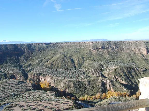 Megalithic Dolmens of Gorafe
 Dolmens of Sierrezuela Posadas