Los Yesaresa walk in the Karst en Yesos de Sorbas Nature Reserve in Almeria, Andalucia starts at the abandoned village of Marchalisco Viñicas
By Nick Nutter | Updated 11 Apr 2023 | Almería | Walking |
Login to add to YOUR Favourites ![]() or Read Later
or Read Later

Gypsum Tumulus with Sorbas sunrise
In 1969, Gabriel Requena and his wife, Isabel Munoz, the last two residents of the mining village of Marchalisco Viñicas, left their home to move to the nearby village of La Huelga. The village was barely 100 years old. Today Marchalisco Viñicas is the start of a walk that allows us to explore the wonders of the Karst en Yesos de Sorbas Natural Park, but first the village.
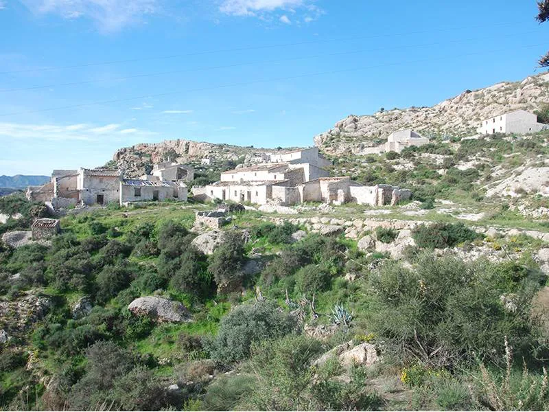

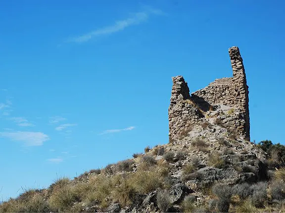
Marchalisco Viñicas
The first record of Marchalisco Viñicas is in a census of 1864, there were 8 houses at that time. The only other historical record seems to be news of a flood in 1943 that did some damage to the buildings. At its peak, the community consisted of 15 houses. The male occupants worked one of three open cast gypsum mines in the immediate area. The children had to go to the nearest school, at La Herreria, about 1 hour’s walk away across the valley. The nearest doctor was at Sorbas, only 6 kilometres away as the crow flies, but a four-hour donkey ride along the unmade track that connected Marchalisco Viñicas with the outside world. Even the drinking water had to be obtained at a small village called Umbria, an hours journey away by horse, the local supply being contaminated with high concentrations of gypsum. By the 1950s, gypsum mining was no longer employing as many manual workers, this combined with the harsh living conditions persuaded the occupants to start leaving for other cities and surrounding towns.

Bread Oven Marchalisco Viñicas
To reach the start of the walk, leave the A7 road at junction 510, onto the AL 6110, signposted La Herreria. The walk starts at a rough, unmarked, track that leads off the roundabout on the north side of the A7. Park wherever you can.

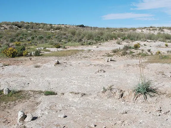
Gypsum markers on the plateau
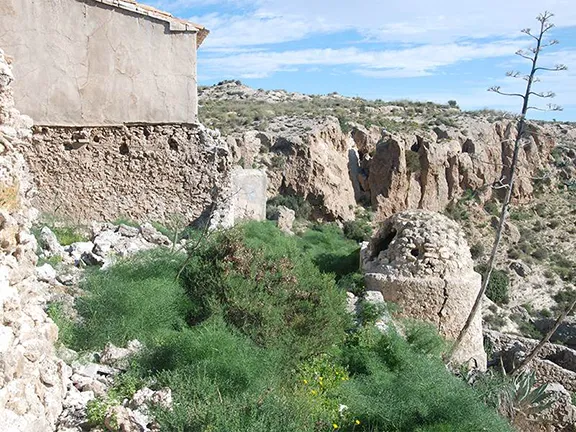
The ruined village is clearly visible above, just below the ridgeline. As you walk up to the ruins you pass the cultivated terraces on which the villagers grew almond trees, carob trees, and all their vegetables. When you reach the ruins, one of the first places you pass is the public laundry situated where water emerges from the hill, its source being a cave called Cueva de Agua about two kilometres away. The water contains calcium sulphate and is not suitable for drinking.
The track takes you up through the village. Towards the top you will see the communal bread oven and, as you reach the top of the village and move on to the plateau behind, you will see a threshing circle. The villagers grew wheat and barley and kept sheep on this plateau.

Puente La Mora
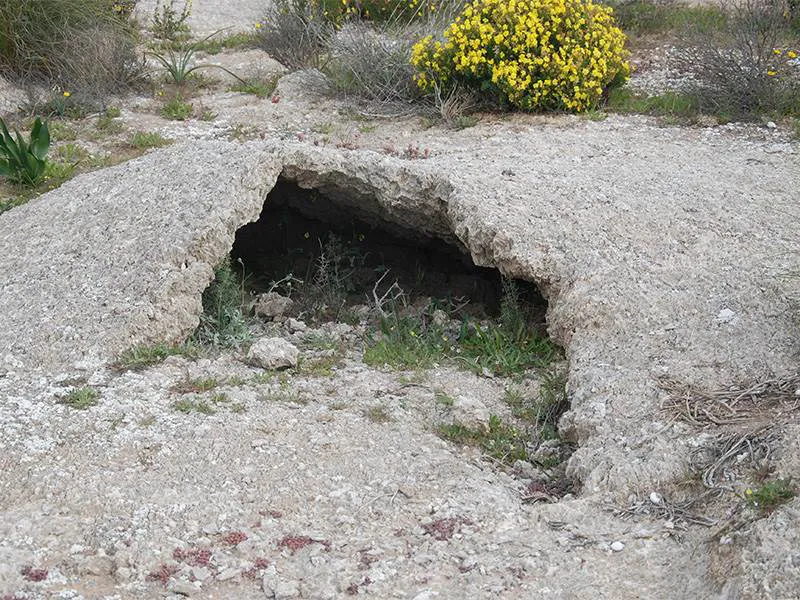
From the threshing circle, the track is marked by parallel lines of gypsum placed on the ground. This soon becomes a proper track. After a kilometre a second track joins from the left, here you head to the right, following arrows painted on wooden posts (See the last paragraph for diversion). Soon you arrive at a Junta information board that explains how tumuli form and, just off the track you can see tumuli in various stages of formation. The image shows a tumulus with one of the rare plants found in this area, the Sorbas sunrose.
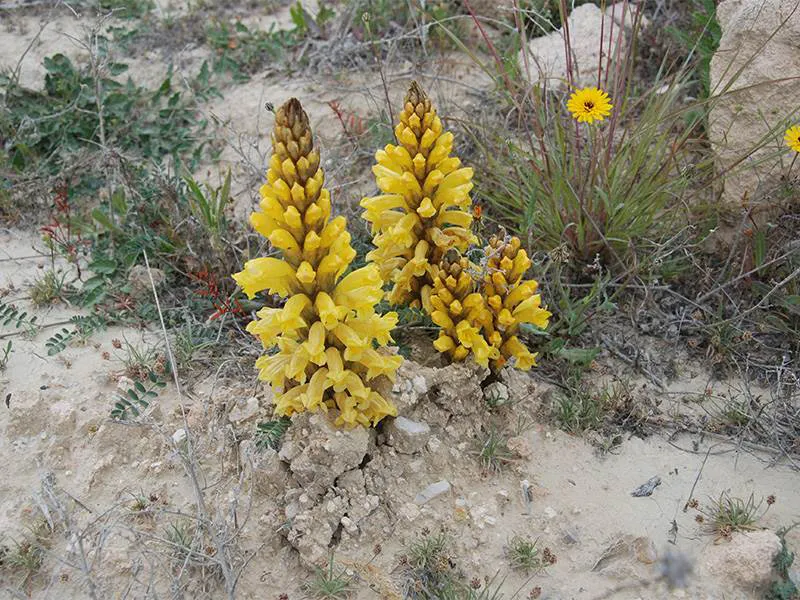

Yellow broomrape
The whole plateau is covered with plants that are tolerant of gypsum, gypsophytes, many of them endemic to this area. They provide a colourful backdrop to the rock outcrops in which the gypsum crystals glitter as they reflect the sunlight. It is a landscape like no other. We were fortunate to see a yellow broomrape (Cistanche phelypaea) a parasitic plant native to the area.
Continue on the track until you reach a fenced off area. Signs warn that this is still a working mine and that explosives are used. Turn sharp right and follow the track, back to Marchalisco Viñicas and from there to the main road. On your way, you pass a large sinkhole with a fig tree growing from it. The roots of the fig tree penetrate the earth for dozens of metres to find water. They are a sure sign that there is water, and a hole for the unwary to fall into.
The total distance is about 6.5 kilometres. The only climb is the first section to the top of the village. There is no water en route so take plenty with you and the rock on which you walk is often very sharp gypsum crystals so stout footwear is essential.
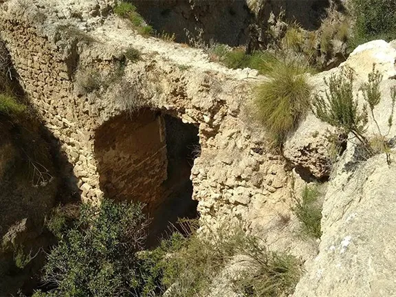
If instead of turning right on the well-trodden path, you continue west for 600 metres, you will arrive at the steep-sided Barranco del Tesoro. You will see a ruined bridge across the Barranco. It is called the Puente La Mora. The legend of how and why it was built lives on in folk tales.
The bridge is on the route of a road that connected Vera with Sorbas until 1880 when the CN 340 was built. There is no record of when the bridge was built. However, the story goes that, during the Moorish occupation, Queen Mora (probably Queen Moraima, the last Sultana of Granada, one of the two wives of the last Nasrid ruler of Granada, Muhammad XII), was visiting dignitaries in the nearby Sierra Cabrera. Her route took her along the old Vera to Sorbas road. The villagers of Sorbas were given 24 hours notice of the visit and told to build a bridge so that the royal party did not have to scrabble down the Barranco. The Moors used their turbans as water containers and manufactured the plaster from the local gypsum. A chain of workers passed the stones up the hill and the bridge was completed in the time allowed. The complete bridge consisted of a single arch, partly ruined but visible today, on top of which there was a second row of three arches that held the roadway. The top-level was over 26.4 metres long and 3.3 metres wide and 13.25 metres in height.
The first mention of the bridge in any historical context was in 1573, making Puente la Mora one of the oldest bridges in the region.
© Visit-Andalucia 2015 - 2024
 Aljambra Tower walk
 Villaricos Coastal Mine Workings Walk
 Ruta La Mina Macenas
 Sorbas Gypsum Karst Paraje Natural
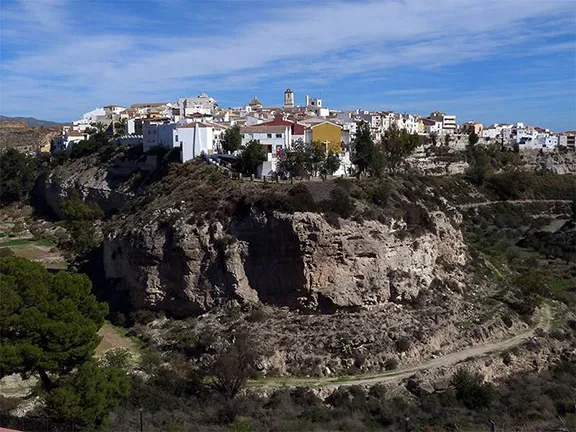 Sorbas
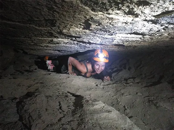 Sorbas Caves